What is Geosteering? A Complete Guide for Drilling Engineers
Introduction
In the dynamic world of petroleum engineering, geosteering has emerged as a pivotal technique for optimizing drilling operations. As the industry strives to maximize hydrocarbon recovery while minimizing costs, the ability to accurately guide the drill bit in real-time becomes essential. This comprehensive guide will delve into the intricacies of geosteering, its methodologies, applications, and relevance in modern drilling operations.
Understanding Geosteering
What is Geosteering?
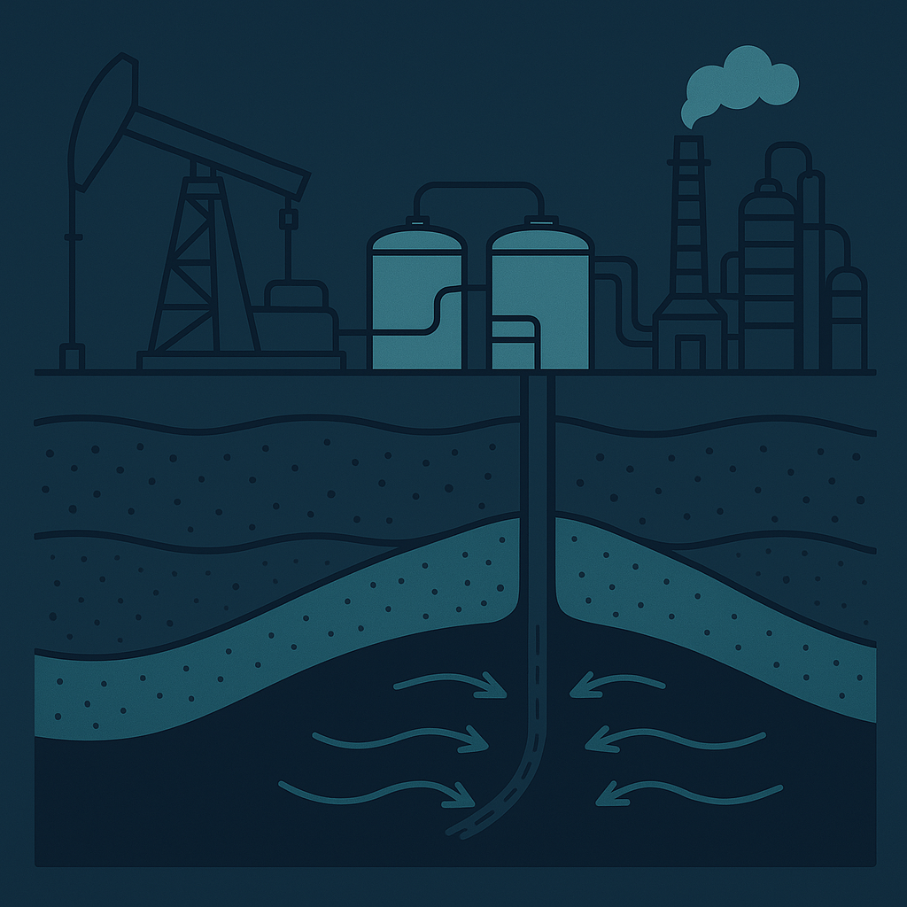
Geosteering is the process of adjusting the trajectory of a drill bit in real-time based on geological data to enhance the likelihood of intersecting productive formations. By integrating geological models with real-time data, drilling engineers can make informed decisions about the drill path, ensuring that the wellbore remains within the target zone. According to the Society of Petroleum Engineers (SPE), effective geosteering can significantly improve well placement, resulting in increased production and reduced drilling costs (SPE-183745).
The Importance of Real-Time Data
The efficacy of geosteering hinges on the availability and interpretation of real-time data. Advanced technologies, such as Logging While Drilling (LWD) and Measurement While Drilling (MWD), provide critical insights into the subsurface geology. These technologies allow engineers to assess lithology, fluid properties, and other geological features as drilling progresses. The adoption of standards like WITSML (Wellsite Information Transfer Standard Markup Language) facilitates the seamless integration of this data, enhancing the decision-making process (WITSML Standards, energistics.org).
Geosteering Techniques
There are several techniques employed in geosteering, including:
- Geological Modeling: Building a 3D geological model based on seismic data and well logs to predict the subsurface structure.
- Real-Time Monitoring: Utilizing LWD and MWD data to monitor the wellbore's position relative to geological features.
- Decision-Making Algorithms: Implementing algorithms that analyze real-time data and suggest adjustments to the drilling path.
Peer-reviewed studies emphasize that combining these techniques can lead to more accurate drilling operations, as evidenced in research published in the SPE Journal (SPE-194438).
Practical Application of Geosteering
Operational Examples
-
Targeting Complex Reservoirs: In a recent operation in the North Sea, engineers utilized geosteering to navigate through a challenging chalk reservoir. By continuously updating the geological model with LWD data, they were able to steer the wellbore into the most productive zones, resulting in a significant increase in oil recovery.
-
Minimizing Affected Areas: During a drilling project in the Permian Basin, real-time geosteering allowed drilling engineers to minimize the foot print of the wellbore while maximizing the exposure to the target reservoir. This was achieved through the integration of GeoMaster’s LookAhead feature, which provides predictive analytics to foresee geological challenges.
-
Enhancing Horizontal Drilling: In horizontal drilling operations, geosteering plays a crucial role in maintaining the wellbore within the desired pay zone. By utilizing GeoSteering Workspace and its real-time analytics, engineers can adjust the drill path dynamically, improving the overall efficiency of the operation.
Summary
Geosteering represents a paradigm shift in drilling engineering, allowing teams to leverage real-time data for informed decision-making. By employing advanced technologies and adhering to industry standards like WITSML, drilling engineers can optimize well placement and enhance hydrocarbon recovery.
For engineers looking to integrate geosteering into their operations, GeoMaster provides a comprehensive suite of tools, including DrillTracker for real-time monitoring and GeoEngine AI for predictive analytics.
Harness the power of geosteering for your drilling operations.
GeoMaster handles this natively — Start your free trial.
References
- SPE-183745. "Geosteering for Improved Well Placement," Society of Petroleum Engineers.
- SPE-194438. "Real-Time Geosteering in Complex Reservoirs," Society of Petroleum Engineers.
- Energistics. "WITSML Standards." energistics.org.